 Stone residents this morning woke to a dusting of snow, with further snow forecast for Friday and the Weekend

With winter beginning to bite there should be no surprise that snow and ice will be on their way too. This morning the town woke to a dusting of snow and forecasts predict more snow for Friday as well as over the weekend.
Car drivers are reminded to take extra care when venturing out as major roads will be the focus for the Staffordshire County Council gritting teams leaving local roads susceptible to icing. For drivers our advice is:
- Head out 5 minutes earlier than usual
- Start you car and clear your windows
- Ensure the inside of your windows are free from ice and condensation before setting off
- Ensure that your windscreen wiper washers are topped up with a good level of screen wash
- Always have a warm coat with in case of breakdown
- Consider carrying a shovel and blanket if the forecast is for heavy snow
- Ensure that your tyres are correctly inflated
- If the weather is bad always consider whether your journey is necessary
School Closures
When the weather gets bad then often the local schools will be closed. The county council provide an up to date list on school closures so this is always a great place to check in the mornings if you’ve got school children – https://www.staffordshire.gov.uk/education/schoolsandcolleges/emergencyclosures/schoolclosurelist/schoolclosurelist.aspx
Elderly and Vulnerable

Always consider neighbours and friends who may be unable to get out if the weather is bad. Give them a knock or drop around a note to see if you can help in anyway and that they are OK.
[box type=”warning” align=”aligncenter” ]
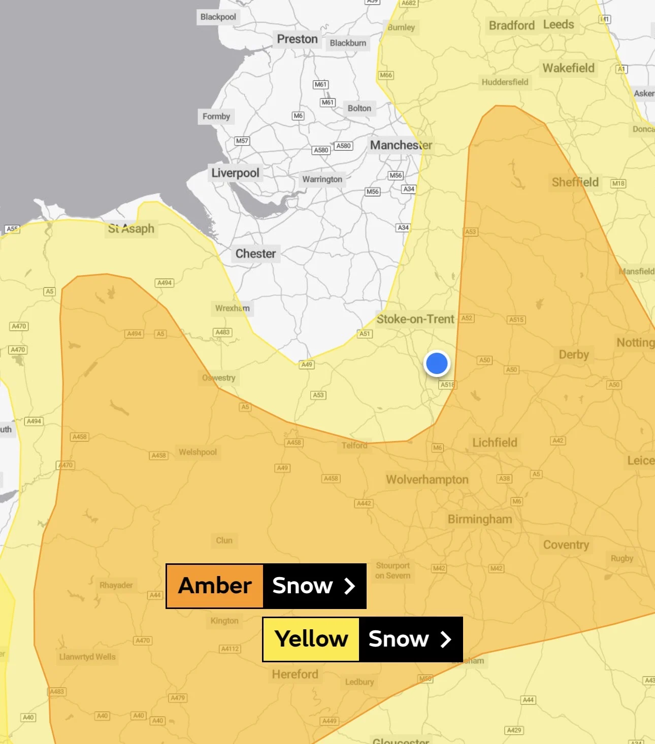
Met Office – Yellow Weather Warning
Between 00:05 Fri 8th and 18:00 Sat 9th During Friday, increasingly frequent snow showers already affecting parts of Scotland, Northern Ireland and northern England will extend across many other northern and western parts of the UK. 2-5 cm of snow is likely in places over the warning area. 10-20 cm is possible for some locations, mainly in northern Scotland, Northern Ireland, north Wales and perhaps the northwest Midlands. Icy surfaces are also likely to be an additional hazard, especially overnight. The heaviest and most frequent snow showers will progressively become confined to northeast Scotland during Saturday. Possible travel delays on roads stranding some vehicles and passengers with possible delays and cancellations to rail and air travel. Some rural communities could be cut off and power supplies interrupted. Probably some icy stretches on some untreated roads, pavements and cycle paths. Some injuries from slips and falls on icy and snowy surfaces. This warning has been updated to extend east to include more of the Pennines.[/box]