Stone looks likely to avoid the Met Office’s amber snow warning as Storm Goretti moves in, although it is a close run thing.
UPDATE: Stone has now been moved into the Amber warning area – see our new article for futher details
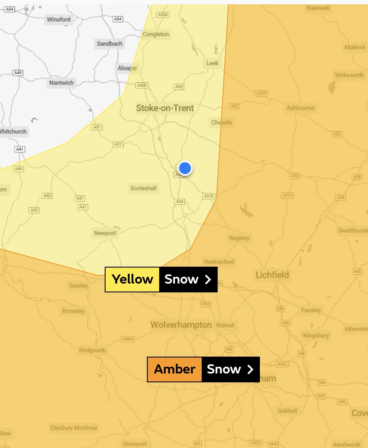
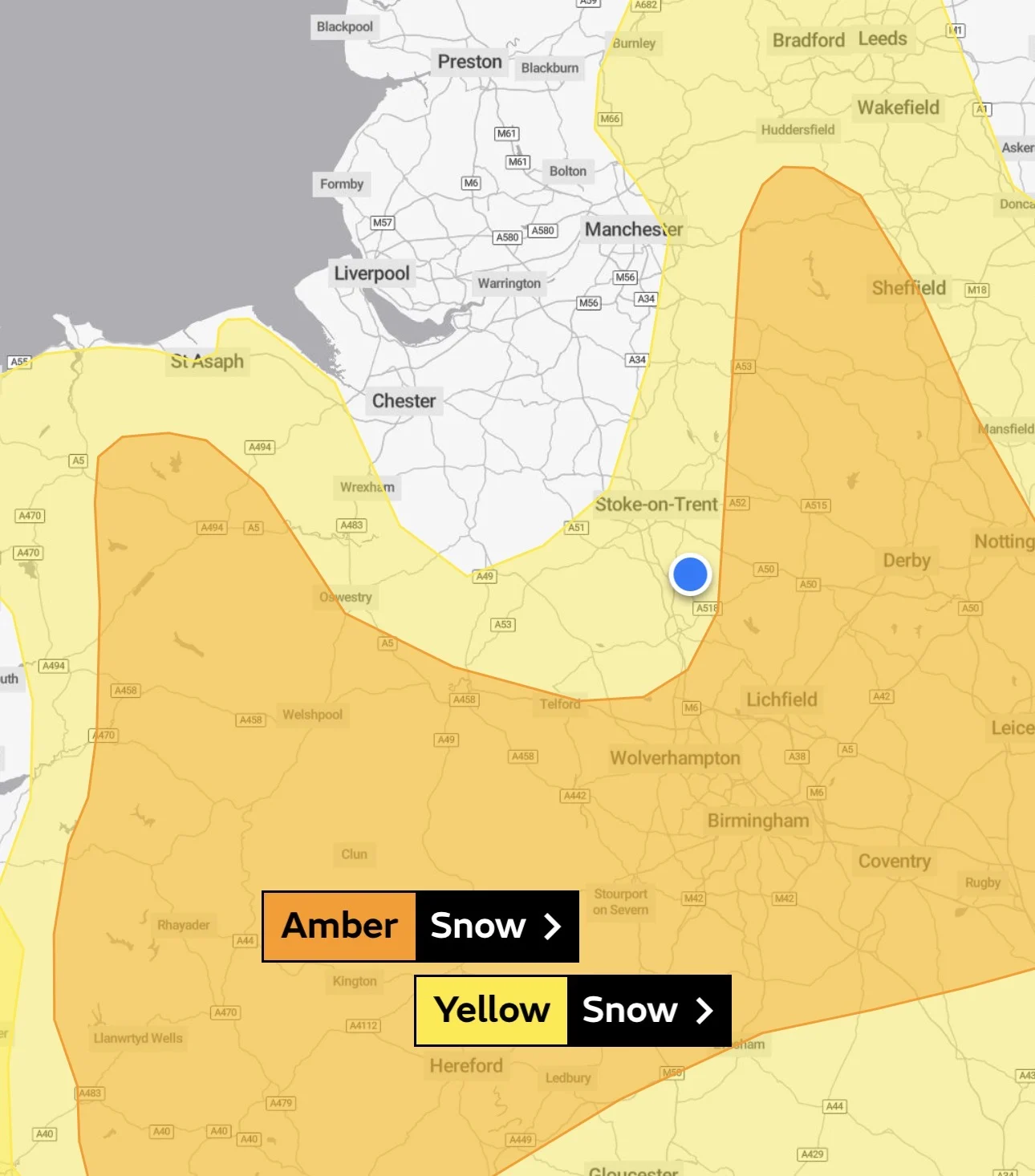
Current warning maps place the town in the yellow snow warning area, with the amber warning starting just a short distance away to the south and east. That puts Stone on the edge of the more severe conditions, but not inside them.
In practical terms, that suggests we may miss the heaviest snowfall expected elsewhere. However, the Met Office is clear that this is not a guarantee, and even small changes in the storm’s path could shift things either way.
What that means locally
Rain is forecast to arrive during Thursday afternoon and evening, turning colder overnight. As temperatures drop, that rain is expected to turn to snow in places.
Even under a yellow warning, the Met Office says disruption is possible.
Roads could be slow going, particularly early on Friday. Untreated surfaces may become icy if temperatures fall sharply overnight. Public transport could also be affected if conditions deteriorate.
Widespread power cuts are not expected in the yellow area, but isolated issues cannot be ruled out, especially if heavier bands of snow drift closer to the amber boundary.
Advice for Stone residents
The advice is fairly simple. If you need to travel, allow extra time and keep an eye on conditions. If you do not need to be out early on Friday, it may be worth waiting until things ease.
It is also sensible to take a few basic precautions at home. Charging phones, keeping a torch to hand, and checking on neighbours who may struggle in cold weather are all small steps that can help.

At the moment, Stone appears set to dodge the worst of Storm Goretti. That could still change, and weather warnings can be updated quickly.
Keeping an eye on the forecast through Thursday evening and into Friday morning is the safest bet.
Let’s talk probabilities
It is worth remembering how these warnings are set. The Met Office uses a risk matrix that weighs likelihood against impact.
Yellow sits in the middle ground, where snow is possible but not certain, and where impacts could be disruptive rather than severe.
Amber moves up a step, where snow is more likely and the consequences are expected to be more serious.
At the moment, Stone sits in that lower probability, medium impact box.
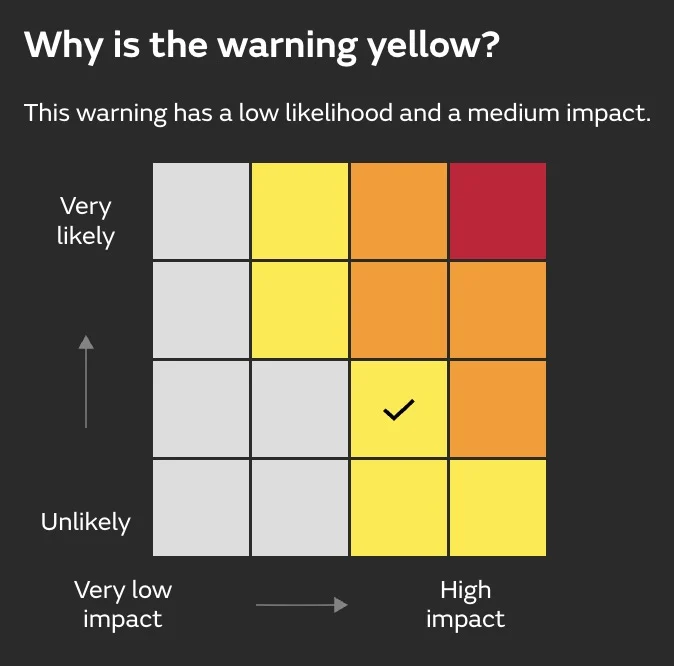
That is why the town remains yellow rather than amber. It does not mean nothing will happen, but it does mean the odds are currently tilted away from the worst case scenarios seen elsewhere.
Here’s what the Staffordshire amber one currently looks like: