Plans have been submitted for up to 95 homes on farmland off Uttoxeter Road on the southern edge of Stone.
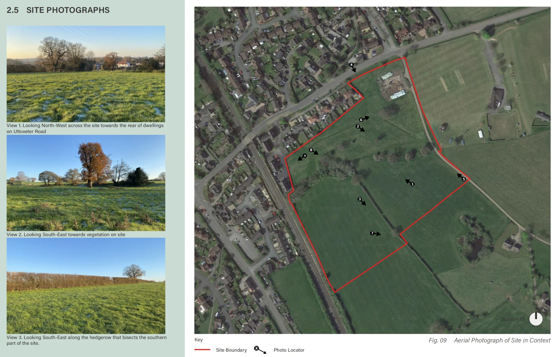
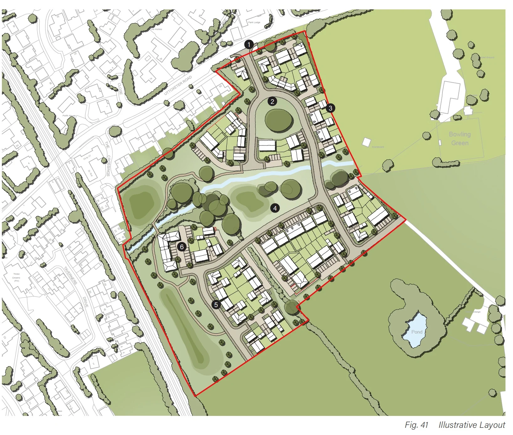
Richborough is seeking outline planning permission for the development on a site of about 4.6 hectares, which sits between existing homes to the north, Little Stoke Cricket Club to the east and the railway line to the west. At this stage, only access is being fixed, with layout, appearance, landscaping and scale left for a later reserved matters application.
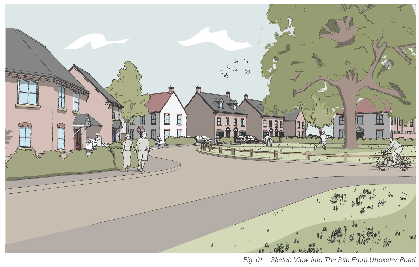
The applicant’s planning statement says the scheme would include 40 per cent affordable housing and that just under half the site would remain as open space, including drainage features. An illustrative layout has been prepared to show how the site could be developed, but that is not the final design.
Access to the site would be from Uttoxeter Road via a new priority T junction, with footways and pedestrian crossing points also proposed. The transport assessment says the access would have a 5.5 metre carriageway, 6 metre junction radii and 2 metre footways.
Traffic and the nearby Aston by Stone level crossing are likely to be among the issues local residents focus on. The applicant’s transport work says no personal injury accidents were recorded in the last five years on Uttoxeter Road near the site frontage, at the Lichfield Road junction or at the level crossing itself, and argues the development would not have a severe impact on the wider road network. It also says a contribution is expected towards a red light safety camera at the crossing.
The planning documents also point to a possible contribution towards bringing back the former S3 bus service through the area, along with bus stops on Uttoxeter Road.
Drainage and flooding are also likely to be closely watched. The flood risk assessment says the site is in Flood Zone 1, meaning it has a low risk of river flooding, but notes existing surface water issues around the ditch network, especially towards the western edge near the railway culvert. It proposes three attenuation basins, a swale along the western side of the site and a controlled discharge into the existing ditch network.
On ecology, the applicant says the site includes two Habitats of Principal Importance, hedgerows and broadleaved woodland. The ecological assessment says minor losses would be needed for access, but claims the scheme would still deliver biodiversity net gain above the required 10 per cent threshold. The headline figures given are 10.82 per cent for habitat areas, 10.74 per cent for hedgerows and 36.74 per cent for watercourses.
The heritage material says there are no designated heritage assets on the site itself, no non designated heritage assets recorded within the site boundary, and no clear evidence of significant archaeological remains from the geophysical survey, although further archaeological work could still be required by condition.
This is not the first time housing has been proposed on the land. Earlier applications in 2014 and 2016 were refused when Stafford Borough Council said it could demonstrate a five year housing land supply, although the current planning statement notes the site was later proposed for 97 homes in the borough’s now abandoned Preferred Options Local Plan.
People can view the full planning application, reference 25/41556/OUT, on the Stafford Borough Council planning portal at https://www12.staffordbc.gov.uk/online-applications/. The consultation window is open for comments, with the neighbour consultation expiry date listed as Friday 1 May 2026.


9 comments
Lewis
Stop ruining our already heavily populated town. This is getting ridiculous with all these new build, stone is a “rural” town , the schools are already to the brim, the traffic is horrendous in the mornings and the poor green fields of which we love will be gone forever. not to mention the amount of the amount of houses that have already recently been built.
All it ever is, is profit grabbing so take your cut because obviously because no matter what the people of stone think, they have no say. This will go ahead for the right price.
Sharon Clarke
Firstly you buy your house and not the view. However this doesn’t mean every green space has to be built up on and yes we still get the cows grazing in there and the wildlife. The problem i see living so close to the railway is the volume of traffic, OK 10mins wait time is a while but will be nothing compared to how it will be having 90 + homes a lot having 2 even more cars. As for housing for our grandchildren, how much are these houses going to cost ?. Everything aside its far too busy a road as it is and I believe as you enter into 30 mph speed limit after the bend it will be dangerous. Local people on that stretch of road know only too well the speed at people drive through. Doctors and dentist too.
Victoria Platt
Just no, there’s no infrastructure to support anymore homes here in Stone! The roads look like 3rd world country road and the traffic is at a stand still most days!
Mel Lester
Absolutely ridiculous, the prodding. coming off Aston Lodge is at a standstill at peak times, with the close proximity to the railway crossing this will just make the problem worse. Also the poor people that live in the older houses on the right hand side as you come over the crossing, they had a beautiful view for all those years, qhat will thos do to the value of those houses? It’s just building houses for the sake of it, with no consideration to existing residents. The town cannot support the number of people living here as it is, without increasing the population even more. Alleynes Academy is full to capacity.
Sharon Clarke
Firstly you buy your house and not the view. However this doesn’t mean every green space has to be built up on and yes we still get the cows grazing in there and the wildlife. The problem i see living so close to the railway is the volume of traffic, OK 10mins wait time is a while but will be nothing compared to how it will be having 90 + homes a lot having 2 even more cars. As for housing for our grandchildren, how much are these houses going to cost ?. Everything aside its far too busy a road as it is and I believe as you enter into 30 mph speed limit after the bend it will be dangerous. Local people on that stretch of road know only too well the speed at people drive through. Doctors and dentist too.
Gareth
I don’t think I’ve ever seen crops as such on here, I don’t know if it’s used for grazing either so if that’s the case the land is just unused fields surely. As far as the traffic concerns because of the rail crossing, is it really going to make a huge difference? I don’t think I’ve ever been delayed by 10’s of minutes or anything there but I don’t normally transit through there in the morning when peak traffic could be. As long as the land drainage is thought about and more pressure is placed on the local council to invest on local infrastructure then why not.
Lynne Colclough
This is ludicrous, the road is extremely dangerous as it is. The junction off the Aston Lodge Estate is the only way into the estate. The traffic is at a standstill at peak times, plus the level crossing and traffic lights cause massive delays.
The Doctors, Dentists and schools are full to capacity as it is. We have a rising crime rate too. Can the planners not see that this is going to cause a ricochet of problems for our once lovely town? Stone is over developed, enough is enough.
Nigel Clarke
NOT AGAIN ( when is common sense going to prevail )
We should not be building on fertile farm land ( Especially in this very uncertain time when we should be supporting our farmers to produce more and stop the reliance on imports )
Uttoxeter Road is already a bottle neck for transport with the railway crossing, traffic lights and being the only road from Stone to Uttoxeter and surrounding existing housing estates and villages, not to mention the poor road surface and narrow width in places ( adding potentially another 180 cars from another development )( most homes have 2 cars) Would even make things worse
Not enough Schools, Doctors, Dentists and other necessary services
This land is subject to flooding, especially in the winter farmers have learned to manage this for pasture, if you covered this site with concrete ad tarmac where would the excess water go without causing problems elsewhere
Planning permission has already been granted for housing off the Stone Road near to where it meets the Lichfield Road and the extension to the new housing estate on the Eccleshall Road out of Stone
Tom Anderson
At the moment there can be a large buildup of vehicles at the crossing waiting on a train or trains to pass. This tailsbacks onto the main Litchfield Rd causing problems at the traffic lights. To grant this is only going to vastly add to this problem. I see the developers have not highlighted this issue or proposed a solution.